cuccaro media
Drone services
Cuccaro Media elevates your projects with cutting-edge drone services that deliver stunning aerial imagery and valuable insights. Our technology empowers clients in various industries to make informed decisions, streamline processes, and enhance overall project success.
Elevate Your Vision
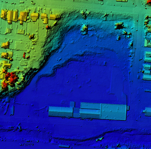
Aerial imagery from Cuccaro Media goes beyond ordinary photographs as processed images become dynamic assets containing x, y, and z coordinates along with true color data. Each carefully processed image holds enough information to recreate a three-dimensional model from the overlapping two-dimensional pictures captured. By using drones, we reveal a range of perspectives, turning the sky into the starting point of an incredible journey.
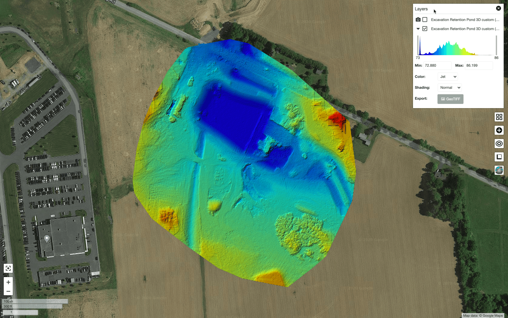
The Digital Surface Model(DSM) image to the right or just above was created from 450 overlapping photos encompassing 36 acres. See the Plum Creek project in the 3D model gallery below for the 3D model.
Flying Tools
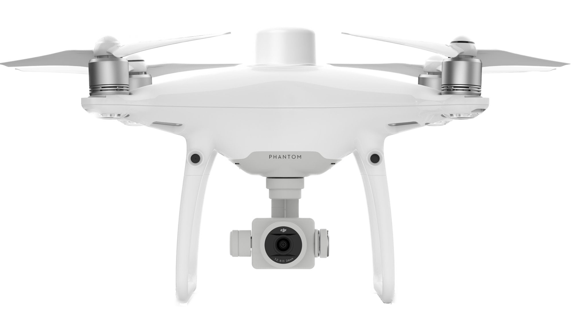
Cuccaro Media harnesses cutting-edge unmanned aircraft systems to revolutionize data collection and project management for businesses. Our solutions enhance efficiency and safety while delivering stunning visuals and critical insights across diverse industries.
Construction
Explore a budget-friendly option that allows you to assess and review your projects thoroughly, improving accuracy and transparency to achieve the best results.
Real Estate
Enhance your property listings with stunning aerial photography that showcase your properties' distinct features and their surroundings, effectively captivating potential buyers.
videography
Harnessing advanced UAS technology, we produce stunning video footage that captures the heart of your project, revealing both sweeping vistas and detailed nuances.
Photography
Images taken from unusual angles offer a fresh and engaging perspective that turns simple scenes into remarkable visual stories.
Discover New Perspectives With Cuccaro Media
Contact Cuccaro Media today to unlock your project's potential and gain a competitive edge. Our expert team provides innovative drone solutions that elevate your strategy and realize your vision with stunning aerial insights and seamless execution.
Unlocking Drone data
Point Collection
This collection of points, or point cloud, describes the area of interest in three-dimensional space. Like spots on a leopard, these points wrap the area with each having x, y, z, and color values assigned to them.
highlights
- Used to create a 3D model
- Base model for doing measurements
- Enables profile analysis
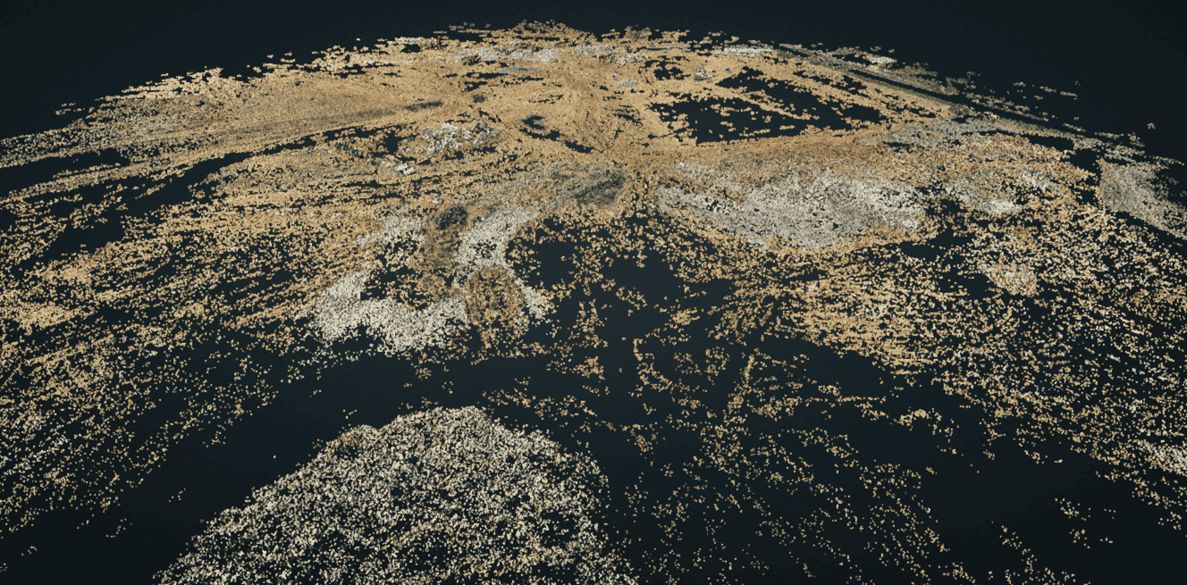
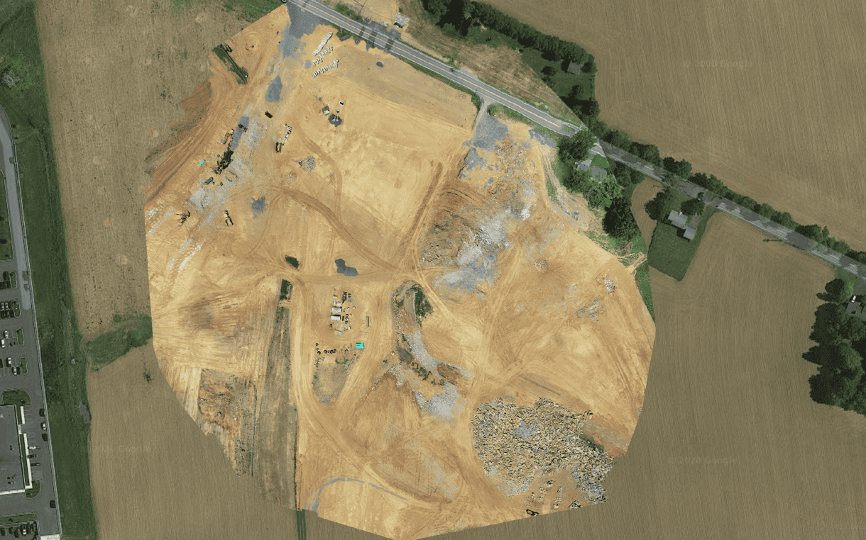
Photo Map
This photo is like a jigsaw puzzle of the mapped area. Also known as an orthophoto, this large picture is pieced together from all the images captured during flight.
highlights
- One photo of the entire site
- Geometrically corrected for accurate measurements
- Great for project progression reporting
Measurements
Measurements by simply clicking and placing points on the model.
Watch the video on the left to see a quick example.
highlights
- Quick and easy way to do volume calcs
- Estimate earthwork
- Confirm subcontractor work
relief map
Digital Elevation Models are graphical representations of height information across the mapped area.
highlights
- Used for flood and drainage modeling
- Easy visual terrain relief assessment
- Useful for landscape modeling
3D Model
Three-dimensional models facilitate easy and useful project visualization.
Watch a short virtual fly through to the right.
highlights
- Great for a virtual tour of the project
- Used for doing as-builts
- Helps stakeholders visualize progress
3D Models gallery
Drone service rates
Daily
For Large Size Projects- Plan flight & check airspace
- Post process images
- Generate 100 aerial photos
- One 2D product (photo map, relief map)
- One video from captured footage
- 3D models priced based upon size + and complexity of the project
- Insurance based upon project
- Contact us for additional options
Half Day
For Medium Size Projects- Plan flight & check airspace
- Post process content
- Generate 50 aerial photos
- One 2D product (photo map, relief map)
- One video from captured footage
- 3D models priced based upon size and complexity of the project
- Insurance based upon project
- Contact us for additional options
Hourly
For Small SIze Projects- Plan flight & check airspace
- Post process images
- Generate 10 aerial photo)
- One 2D products (photo map, relief map
- One video from captured footage
- 3D models priced based upon size and complexity of the project
- Insurance based upon project
- Contact us for additional options
Elevate Your Vision Today
At Cuccaro Media, we specialize in capturing the essence of your project through stunning aerial visuals that reveal its unique story. Our expert team utilizes advanced drone technology to create captivating imagery that enhances your marketing initiatives and engages your audience on a whole new level.